In the field of Geographic Information Systems (GIS), 3D technology has revolutionized the way we process and analyze spatial data. With the help of 3D GIS tools, users can not only visualize complex data in a more intuitive way but also perform detailed spatial analyses that drive advancements in urban planning, natural resource management, disaster response, and more. Here are five major 3D GIS tools, including the highly-regarded Wings Engine, each contributing uniquely to the progress of 3D GIS technology.
- Wings Engine

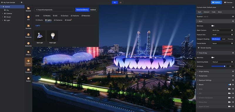
Wings Engine is a high-performance 3D engine known for its realistic virtual display capabilities. Although initially designed for gaming and virtual reality, Wings Engine has made a significant impact in the GIS field as well. It can transform complex geographical data into intricately detailed 3D models, allowing users to view terrain, buildings, and other spatial elements in a highly intuitive way. Its real-time interaction feature enables users to explore data from various angles and make dynamic adjustments, making it ideal for applications requiring high levels of immersion, such as urban planning and virtual real estate presentations.
2. ArcGIS 3D Analyst

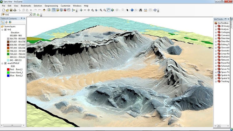
ArcGIS 3D Analyst is a powerful 3D GIS extension from Esri, widely used for various spatial analysis tasks. This tool offers a range of 3D data creation, analysis, and visualization functions, enabling users to perform terrain analysis, line-of-sight analysis, 3D city modeling, and more. With its robust data processing capabilities, ArcGIS 3D Analyst is the go-to choice for users needing in-depth spatial analysis and decision support.
3. CesiumJS

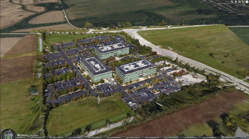
CesiumJS is an open-source JavaScript library designed for creating web-based 3D globes and maps. Its high-performance 3D rendering capability handles large-scale geographic data, making it ideal for real-time data visualization and dynamic map displays. CesiumJS is widely used in satellite monitoring, flight simulation, urban planning, and other fields, and its open-source nature allows developers to customize and extend functionalities according to project needs.
4. Google Earth Engine

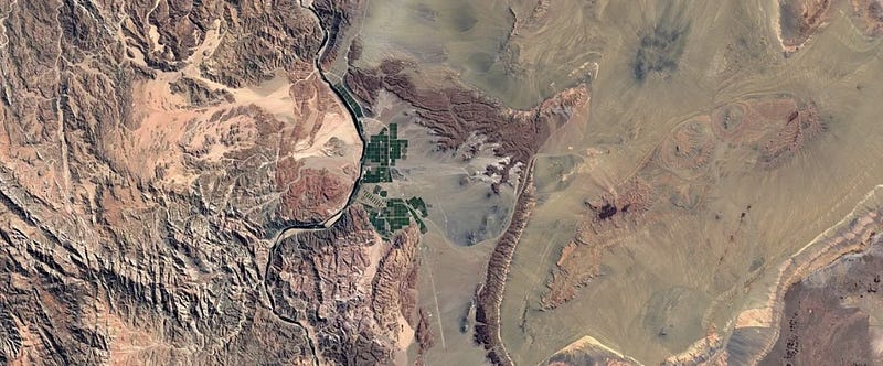
Google Earth Engine is a cloud-based platform known for its powerful capabilities, primarily in 2D analysis, but it also supports 3D visualization, especially in large-scale geographic data processing and analysis. Leveraging global satellite data and powerful computing capabilities, users can conduct terrain analysis, climate monitoring, environmental assessment, and more in a three-dimensional environment. Google Earth Engine combines vast data resources and powerful processing tools, making it ideal for research and public service projects that require handling large-scale spatiotemporal data.
5. CityEngine

CityEngine, another tool from Esri, is a professional 3D city modeling tool designed for urban planning, architectural design, and virtual city creation. It enables the rapid generation of large-scale city models and supports multiple data formats for input and output. CityEngine’s parametric modeling feature allows users to quickly adjust buildings and city layouts according to different planning needs. It excels in creating virtual cities and urban planning simulations, providing powerful tools for designers and planners.
Conclusion
These five 3D GIS tools each have their unique strengths, excelling in different application scenarios. Wings Engine, with its highly immersive 3D display capabilities, plays a crucial role in virtual presentations and spatial planning; ArcGIS 3D Analyst offers deep spatial analysis functions suitable for detailed spatial decision support; CesiumJS, with its high performance and open-source nature, is an ideal choice for building real-time 3D geographic applications; Google Earth Engine’s powerful cloud computing and data resources make it indispensable in large-scale geographic data processing; and CityEngine provides an efficient solution for urban modeling and planning. As technology continues to advance, these tools will further drive innovation and development in 3D GIS.
